Jennifer Debenham discusses the website, Colonial Frontier Massacres in Eastern Australia 1788-1872, which was formally launched at the annual Australian Historical Association’s conference in July by Indigenous Senior Lecturer, Dr Stephanie Gilbert, from the University of Newcastle’s Wollotuka Institute.
The launch session was introduced by project leader, Professor Lyndall Ryan. Dr William (Bill) Pascoe, who designed the website, focused his presentation on how he developed the site as a digital humanities project. He was followed by Dr Mark Brown, the project’s digital cartographer, who explained how mapping technologies can be used to make a visual representation of historical data. Finally, Dr Jennifer Debenham gave an insight into how the messiness of the historical narrative needed to be reconstructed in such a way that its complexity and nuanced narrative threads would fit with, what initially appeared to be inflexible, data structures required by the mapping application. The project was funded with an Australian Research Council Discovery Grant and has taken three years to achieve the current website.
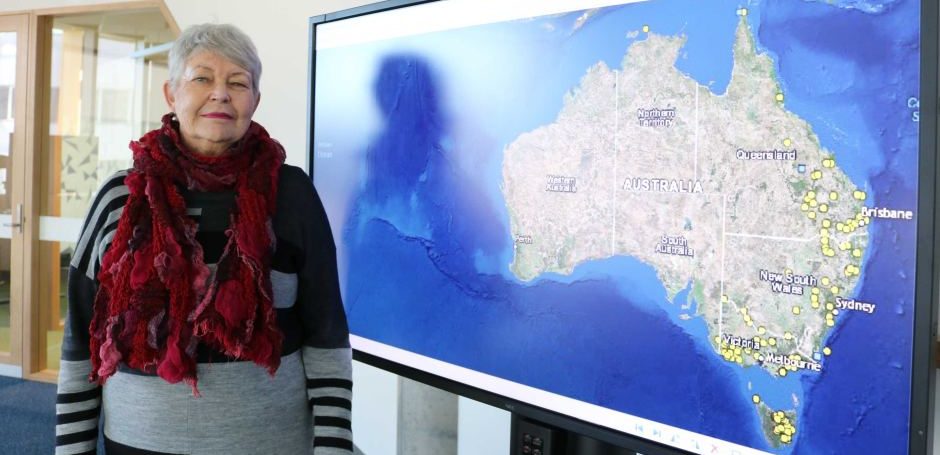
Initially the project was to cover the whole of Australia; however, the number of violent attacks on Aboriginal people was underestimated. To date Victoria and Tasmania are the most complete. We hope to continue working on adding more sites in New South Wales (including the ACT) and Queensland. Then we will focus on South Australia, the Northern Territory and Western Australia. The painstaking research has slowly pieced together details of each incident, bringing together a more intact picture of the Australian frontier.
Within two days of the launch the site had an audience reach of 28 million through newsfeeds on television and newspapers and on other platforms such as Facebook and Twitter. What our Google metrics tell us is that the site went global, indicating the site is user friendly and there is a thirst for this type of information. Most visitors spend between one to 30 minutes on the site and after more than eight weeks, it continues to attract 10 to 12 people at any one time. People are now wanting to get to the truth of the violence of Australia’s colonisation.
Most worthwhile has been the public reaction. Although there have been detractors, these have been remarkably small in number and are mainly concerned with the incident at Risdon Cove in Tasmania, a long-contested site. Many more people have contacted us letting us know of its value, particularly those in education (teachers) and the government. Many others have offered advice, knowledge of different aspects of an incident, and have been generous in offering materials to add to the existing evidence. Some have pointed out errors in location and have asked why some sites were not included given the local evidence of incidents seems strong. We are addressing these queries.
The site engages the public in ways that texts do not. It points to the need for historical narratives and data to be presented in visual, interactive and easily available formats. To reach the broader public, professional historians must consider presenting our work in new ways in this digital age.
Image: Professor Ryan with the map, Colonial Frontier Massacres in Eastern Australia 1788-1872